GINA

News

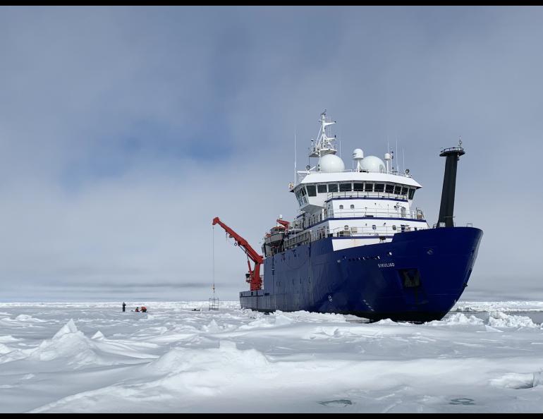
GINA provides a guiding hand in Arctic Ocean research

Satellite imagery produced at GINA helps the Sikuliaq research vessel weave its way through the arctic ocean. “When you are working in ice, the ice controls where you are,” says Steve Roberts, the Sikuliaq’s science systems engineer. “Knowing where sea ice is at all times is critical.” Article can be viewed here: https://www.gi.alaska.edu/news/gina-provides-guiding-hand-arctic-ocean-research

Webinar: Using Alaska’s Fire Dashboards

Jennifer Jenkins will be going through some of the functionality of ArcGIS Online hosted web applications, answering questions, and will demonstrate updated versions of the AICC Dashboard Series. Registration available here. Contact Name: Alison D York Contact E-mail: ayork@alaska.edu

KTVF Science For Alaska

Jen Delamere and Chris Waigle summarized their Science for Alaska lecture “Firewatch: Fire landscapes from Air and Space” on KTVF with Ryan Osborne. Tune in for a few minutes of a fun question and answer series

Alaska’s Changing Wildfire Environment Report

The report highlights recent wildfire trends in Alaska, their impacts to humans & climate change, and the essential relationship of wildfire managers and scientists. The role of direct broadcast satellite data is highlighted. A PDF is available for download: https://www.frames.gov/afsc/alaskas-changing-wildfire-environment.

AGU 2020

CHECK OUT AGU 2020 SESSION NOAA Satellite Proving Grounds to Enhance User Applications I IN034-02 Peter Hickman: VIIRS Direct Broadcast Advances for Improved Wildland Fire Monitoring in Alaska IN034-09 Jen Delamere: Proving Ground Activities: A Direct Broadcast Partnership at the Geographic Information Network of Alaska