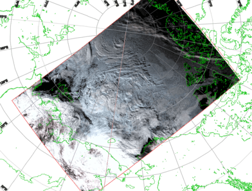
Satellite Detects Major Storm in the Gulf of Alaska
This view of surface wind speeds at 12:28 UTC 23 Nov 2020 was produced from AMSR2 microwave data on the GCOM-W satellite. A large area of 50+ knot winds was detected near the center of the storm.
Satellites that GINA track provide imagery used to detect fires across Alaska. Data here-> fsapps.nwcg.gov
Satellite data imagery is obtained by the GINA owned and operated “Big Dog” antenna located on the roof of UAF’s Akasofu building. This image is the first satellite pass down linked on August 23, 2001, at 01:22 GMT.