A Retrospective
On August 3, 2026, NOAA announced the cessation of Suomi National Polar Orbiting Partnership (S-NPP) data transmission to take place on November 2, 2026 at 1300 UTC. After over 15 years of service, this will bookend its significant contribution to the advancement of satellite observations in Alaska and around the globe. Thankfully, this loss comes amid the inception of a new era of polar-orbiting satellites in the Joint Polar Satellite System (JPSS).
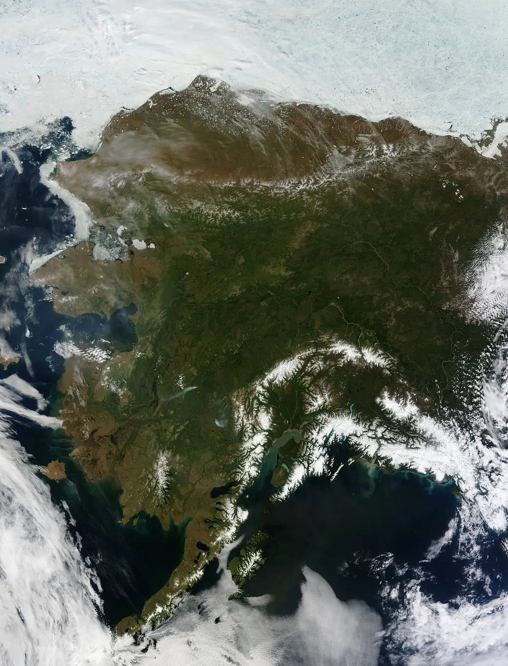
Alaska: Wide View (2013) – Credit: Nasa
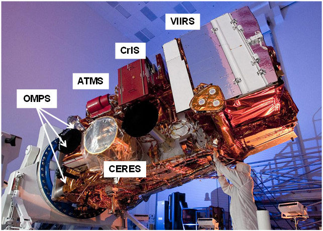
At the time S-NPP was launched, on October 28, 2011, the existing weather-focussed polar-orbiting satellites consisted of NASA’s Polar Operational Environmental Satellites (POES), the European Organisation for the Exploitation of Meteorological Satellites’ (EUMETSAT) flagship Metop-A, and NASA’s Earth Observation System (EOS). S-NPP improved upon EOS’s research-oriented instruments as well as POES’s meteorological observation instruments, combining them into one unified system and bridging operational and academic contributions. This is possible due to the breadth of state-of-the-art technology implemented into the S-NPP product suite:
- Visible Infrared Imaging Radiometer Suite (VIIRS) – This imager allows for observation of wildfires, snow/Ice, sea-surface temperatures, vegetation, smoke, and clouds.
- Cross-Track Infrared Sounder (CrIS) – CrIS contributes to atmospheric sounding of temperature and water vapor with data incorporation into numerical weather prediction models as a major function.
- Advanced Technology Microwave Sounder (ATMS) – The microwave capability of ATMS makes measurement through clouds possible, enabling a full sounding of the atmosphere.
- Ozone Mapping and Profiler Suite (OMPS) – OMPS observes the complete vertical columns of ozone and other aerosols, like ash and dust, to monitor their global distributions.
- Clouds and the Earth’s Radiant Energy System (CERES) – Incoming and outgoing radiation can be measured with this sensor, increasing awareness of Earth’s energy balance and improving climate models in the process.
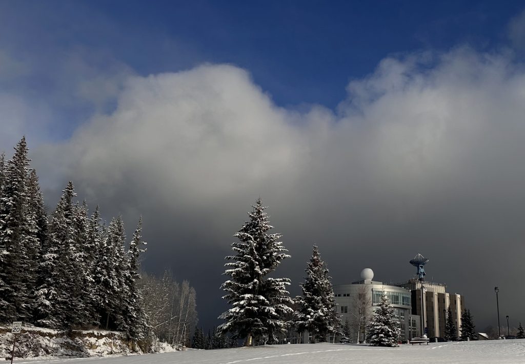
S-NPP data has been utilized around the globe, but serves a unique operational role in Alaskan wildfire, flood, volcanic, surface, and atmospheric monitoring. This region receives polar-orbiting data from satellites like S-NPP at a higher regularity than lower latitudes, making it a crucial tool for many geophysical organizations here, including the National Weather Service and Alaska Fire Service as well as GINA itself. The ‘Big Dog’ antenna on the roof of the University of Alaska Fairbanks’s Akasofu building has been the primary downlinking instrument providing Direct Broadcast data from S-NPP. This allows for lower latency distribution of this imagery to GINA’s various partners within 30 minutes, improving real-time observation.
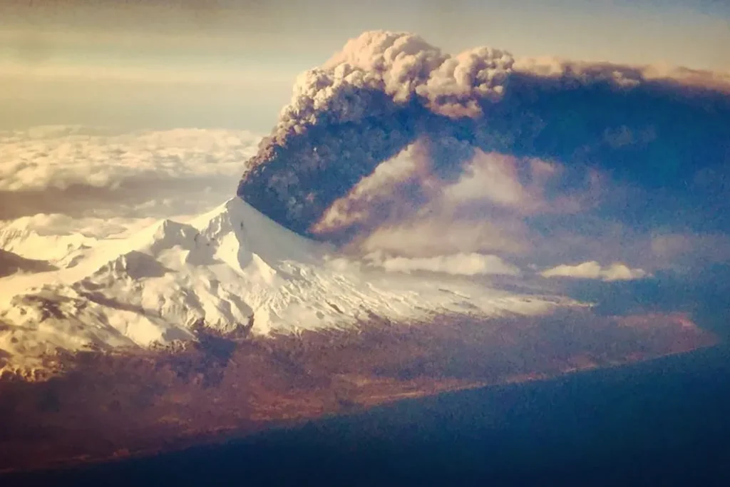
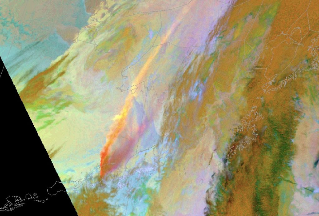
One notable example of this satellite’s impact comes from a March 2016 eruption of Mount Pavlof, a volcano on the Alaskan Peninsula. Shown below, to the right, is a display of the Volcanic Ash RGB from S-NPP, the smoke plume being visible in red and yellow colors. This tool was used to track the ash as it rose up and out toward mainland Alaska. To the left, a view of the eruption from a nearby plane. This eruption was located in a remote part of Alaska and only resulted in cancelled flights and ashfall in some nearby villages.
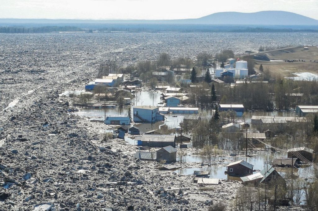
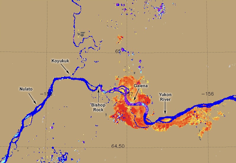
Another case, the 2013 Galena Flood, was a major event in interior Alaska. This was the result of a downstream ice jam that raised water levels on the Yukon River and flooded the small town of Galena during that season’s spring ice breakup. As shown in the left image below, 90% of buildings in town were flooded, and half became uninhabitable in the disaster’s wake. Due to the sparse cloud cover during the course of the flood, the water’s extent and, by proxy, its depth, could be monitored by the VIIRS Flood Map tool and validated by the visible imagers onboard S-NPP. This flood map product can be seen in the right image below.
Galena is over 250 miles from the nearest major town, Fairbanks, and is only accessible by plane or via the Yukon. This means that, outside direct airborne observation, which can be expensive and time-consuming, satellite data was the only method by which emergency managers could determine the flood’s scale in real time and coordinate evacuation operations accordingly. In this application, S-NPP was invaluable.
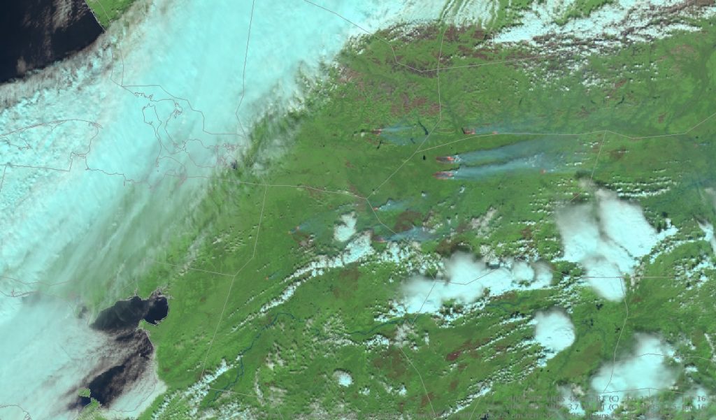
One of the most crucial functions of S-NPP was its fire monitoring capability. In Alaska, observation of wildfires before satellites occurred through aircraft reports and scouting patrols, which were not always holistic. Due to the enhanced polar coverage of S-NPP, however, wildfire management services can be notified of outbreaks even in remote areas, alerting nearby towns, taking action where necessary, and issuing air quality forecasts for regions downwind. Seaman et al. (2023) outline this and several further applications of satellite data in wildfire operations. This outbreak, seen below, occurred in July of 2016 throughout the western Alaskan interior, where population centers are dispersed and road coverage minimal. Using the FireColor RGB, fire hotspots and be observed in bright orange with smoke plumes emanating in blue-gray colors toward the east.
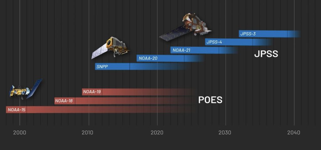
Although S-NPP, a landmark resource, is now being decommissioned, it will make way for a bright future of polar satellite observations. The subsequent satellites in the JPSS system, NOAA-20 and NOAA-21, were launched in 2017 and 2022, respectively, and have been providing data for several years. In this generation, many improvements have been made to data transmission, keeping core instrumentation (VIIRS, CrIS, ATMS) similar to retain data continuity. The following two satellites in the constellation, JPSS-4 and JPSS-3, are expected to be launched in 2027 and 2032, respectively, bringing a next-generation CERES improvement in the “Libera” radiometer as well as the new OMPS-limb profiler to provide vertical distributions of ozone and other aerosols. A timeline of these and previous Polar-satellite systems, shown below, highlights S-NPP’s critical role in the transition between POES and JPSS.
By Kaz Nyzio