


By Grace Veenstra
This article can also be found in UAF’s Aurora magazine in the Fall 2022 issue, and in the IAWF’s Wildfire magazine in the 2023 Q1 issue.
“It may be relatively calm, a little smokey,” Johnson said. “The fire is smoldering and easily put out by beating out the flames and cutting back the brush. But on larger, more intense, rapidly growing fires, you will see a smoke column rising into the sky, smell the smoke in the air, feel heat from the fire if you are close enough.”
Johnson spent two weeks in the summer of 2022 fighting the Donut fire about 30 miles (48 kilometres) south of Ruby, Alaska, a village on the Yukon River. Johnson and three other smokejumpers protected a cabin from the advancing flames. Hundreds of wildland fires burned more than 3 million acres in over 580 blazes across the state in 2022. According to the Alaska Interagency Coordination Center, 2022’s fires burned the fifth-largest area since 1990. The record season came in 2004, when over 6.5 million acres burned across Alaska.
How do fire managers track and monitor these massive fires while dispatching and protecting firefighters like Pat Johnson?
The answer, at least in part, is satellites.

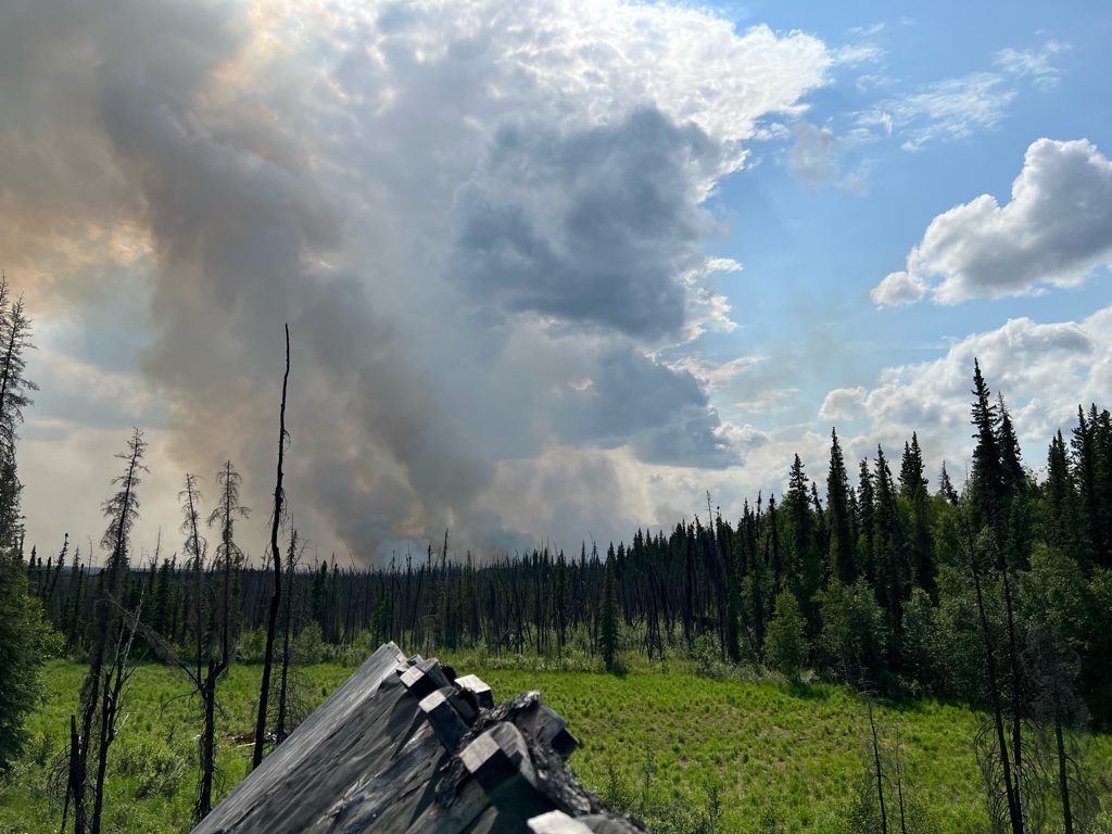

Clockwise from top left: Smokejumper Pat Johnson in 2019 outside the BLM AFS headquarters, suited up and ready to go; smoke rises from the Donut Fire burning south of Ruby, a Yukon River village 240 miles west of Fairbanks, in summer 2022; burn scars from the Donut Fire surround a cabin in this photograph taken as smokejumpers flew away in summer 2022. Photos courtesy of Pat Johnson.
Satellites and Fire Points
Carl Dierking is the satellite liaison at the Geographic Information Network of Alaska, part of the Geophysical Institute at the University of Alaska Fairbanks. GINA collects and processes the raw data received from the Joint Polar Satellite System. GINA makes this information available to the public as data and visuals. The information helps scientists such as meteorologists and oceanographers, but GINA’s staff also provides information to agencies like the Alaska Fire Service and the Alaska Volcano Observatory.
“GINA’s role in fire management is to provide fire-related satellite imagery as quickly as possible so the managers can make proper decisions,” Dierking said.
GINA does this through “direct broadcast,” where a satellite scans Earth as it passes overhead and simultaneously transmits that data to antennas on the ground. This allows GINA to publish data in near real time, about 15 to 20 minutes after the satellite data finishes downloading.

(Left) Red dots on this June 8, 2022, image of the Tatlawiksuk Fire show the heat points that indicate fire growth. The fire, centered in the upper Tatlawiksuk and Selatna rivers, burned an area south of McGrath, a village located about 275 miles southwest of Fairbanks on the upper Kuskokwim River in Interior Alaska. Image from the Alaska Wildland Fire Information Map.
Among its fire-related products, GINA produces “fire heat points,” which are used to aid fire managers.
Users of the Alaska Wildland Fire Information Map are greeted with a view of shaded fire perimeters and burn areas, as well as collections of red dots. These dots are known as “heat points” or the VIIRS Active Fire Detection Algorithm, and represent points of intense radiation such as fires.
Volcanoes and industrial locations can also create heat points, since they emit similar levels of energy. But since they occur persistently in the same location, managers can tell the computers to ignore them.
Heat points are plotted in the wildland fire map and others like it, which are then used by Alaskan fire agencies. The map is accessible by the public and organizations like the Alaska Interagency Coordination Center, a group of Alaska agencies that handles wildland fires.
From here, the heat points and other fire products are used to inform fire managers about a fire’s growth and what the response should be.
Once fire managers see a new heat point, their response depends on the fire location and what it is being threatened. They might choose to send out aircraft and firefighters like Johnson to fight it in the air and on the ground. Or they may decide to let the fire burn and monitor it to see if and when suppression may be needed.
On July 23, 2022 the Alaska Fire Service officer for the upper Yukon region noticed heat points on the wildland fire map about 32 miles northwest of Fort Yukon. With the help of a GIS specialist, he determined it was threatening a nearby cabin. After an aircraft team verified the Kochaco Fire, four water scoopers and eight smokejumpers were deployed that afternoon to protect the cabin.
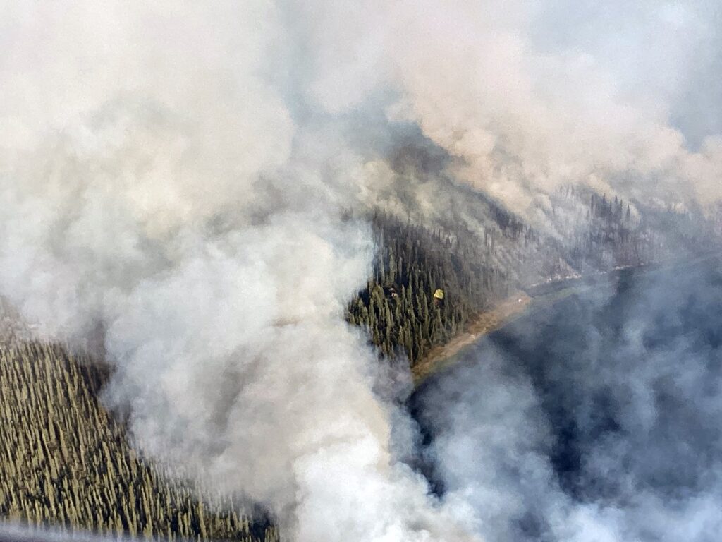
The Kochaco Fire burns near a cabin in a black spruce forest near Fort Yukon, 150 miles northeast of Fairbanks, on Aug. 4, 2022. A yellow tarp over a smokejumper’s camp lies to the right of the cabin. Photo by Chris Bixby, U.S. Bureau of Land Management’s Alaska Fire Service.
“Fires that occur in Alaska are oftentimes in places that are difficult to reach,” said Robert “Zeke” Ziel, a fire analyst associated with the Alaska Fire Science Consortium, part of UAF’s International Arctic Research Center. Fire analysts like Ziel are responsible for analyzing and predicting the behavior of wildland fires.
“But there are still things that require protection,” Ziel said. “In these instances it’s difficult to maintain knowledge of what that fire is doing and to determine what is being threatened and what needs to be done about it.”
Satellites provide that knowledge. They give us a view into remote areas that lack eyes on the ground.
“Before satellites, everything was done by aircraft,” said Alison York, coordinator for the Alaska Fire Science Consortium. “Fire management in Alaska is still very dependent on aircraft. They are important for the transport of firefighters, supplies and water, and are still used for monitoring.”
Before satellite imagery, most initial fire reports came from private and military pilots who noticed the smoke.
But Alaska has a land area of over 580,000 square miles, and these pilots can’t be everywhere.
Seeing Through the Smoke
In 2007, several days passed before any agencies learned of a tundra fire near the Anaktuvuk River on the North Slope. By then, it had already grown very large. The fire burned for three months and consumed nearly a quarter million acres, making it the largest tundra fire on record for the North Slope.
“Remote fires are a challenge if we can’t catch them early on,” Ziel said. “If you don’t know about it, it’s easy for the fire to get out of control.”
(Right) The 2007 Anaktuvuk River Fire burns tundra on the North Slope in 2007. Photo courtesy of the U.S. Bureau of Land Management’s Alaska Fire Service.

Such fires, and the record-setting 2004 season, where thick smoke grounded the aircraft needed for fighting and monitoring fires, drove home the value of satellites.
Today, GINA and its satellites are a critical part of fire monitoring and detection in Alaska. From Jan. 1 to Sept. 6, 2022, over 260,000 heat points were collected in Alaska and surrounding territories, with over 5,000 in the Fairbanks North Star Borough and 89,000 in the Yukon-Koyukuk Census Area.
In addition to GINA and its fire heat points, satellites like Landsat and Sentinel provide high resolution imagery.
“The satellite imagery and heat points are used to locate and monitor fires so people have a sense of where they’re moving,” York said. “They’re used by fire behavior analysts for longer-term planning in deploying and requesting resources.”
Fire managers use the data every day, preventing the need for hundreds of additional aircraft in the skies, protecting communities across the state and keeping personnel like smokejumper Johnson away from harm.
York put it simply: “This satellite imagery is what is going to help us keep people out of unnecessary risk.”
Wildfires affect many Alaskans each year, whether it’s due to a home being threatened by the flames or difficulty breathing due to the smoke that chokes the air. But thanks to satellites, fire managers and, most importantly, the firefighters risking their lives, we are all kept that much safer.

The moon appears behind the Geographic Information Network of Alaska’s “Big Dog” antenna atop the Akasofu Building at the University of Alaska Fairbanks. Photo courtesy of GINA.
Established in 2001 as an initiative of the University of Alaska president, the Geographic Information Network of Alaska focuses on remote sensing for Alaska and its surrounding oceans. Using its satellite dishes — one at UAF and another 14 miles northeast of Fairbanks — GINA captures the data from polar-orbiting satellites. By collaborating with federal, state, and academic partners, GINA provides this data through public portals. An inventory of satellite images over the state of Alaska is available online, and these images can be freely downloaded.